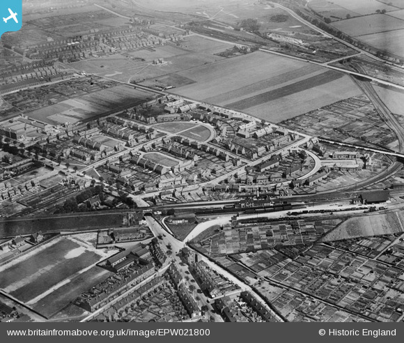
EPW021800 ENGLAND (1928). Tollerton Green and surroundings, Nottingham, 1928
    © Copyright OpenStreetMap contributors and licensed by the OpenStreetMap Foundation. 2025. Cartography is licensed as CC BY-SA.
  
Nearby Images (11)
Details
| Title | [EPW021800] Tollerton Green and surroundings, Nottingham, 1928 | 
| Reference | EPW021800 | 
| Date | July-1928 | 
| Link | |
| Place name | NOTTINGHAM | 
| Parish | |
| District | |
| Country | ENGLAND | 
| Easting / Northing | 454858, 344128 | 
| Longitude / Latitude | -1.182647247407, 52.991362099768 | 
| National Grid Reference | SK549441 | 
Pins
|  Bulwell Common |   ValuerJim | Friday 4th of December 2015 11:24:39 PM | 
|  Hucknall Road |   ValuerJim | Friday 4th of December 2015 11:24:02 PM | 
|  Bulwell Common south junction |   ValuerJim | Friday 4th of December 2015 11:23:31 PM | 
|  Brough Superior Works |   brough | Tuesday 1st of April 2014 01:37:10 PM | 
|  Brough Superior Motorcycle Factory. Home of one of the most prestigious of early motorcycle makes. Made famous by Lawrence of Arabia, among others. |   Dave | Tuesday 11th of December 2012 03:41:17 PM | 
|  Henry Mellish School |   Dave | Tuesday 11th of December 2012 03:34:50 PM | 
| Now sadly demolished May 2013 |   dw1603 | Tuesday 23rd of July 2013 09:11:30 PM | 
|  Kersall Drive |   Dave | Tuesday 11th of December 2012 03:34:21 PM | 
|  Brooklyn Road |   Dave | Tuesday 11th of December 2012 03:33:57 PM | 
|  Saxondale Drive |   Dave | Tuesday 11th of December 2012 03:33:32 PM | 
|  Northern Bridge |   Dave | Tuesday 11th of December 2012 03:33:01 PM | 
| Marks the boundary between Old Basford and Bulwell. |   Dave | Tuesday 11th of December 2012 03:42:24 PM | 
|  Basford and Bulwell station |   Sarah | Thursday 26th of July 2012 03:58:58 AM | 
| Ex Great Northern Railway. |   John Wass | Sunday 14th of June 2015 03:38:28 PM | 
 
             
  ![[EPW021800] Tollerton Green and surroundings, Nottingham, 1928](http://britainfromabove.org.uk/sites/all/libraries/aerofilms-images/public/100x100/EPW/021/EPW021800.jpg) 
  
                                          ![[EPW021801] Tollerton Green and Saxondale Drive, Nottingham, 1928](http://britainfromabove.org.uk/sites/all/libraries/aerofilms-images/public/100x100/EPW/021/EPW021801.jpg) 
 ![[EPW021798] Tollerton Green and Goverton Square, Nottingham, 1928](http://britainfromabove.org.uk/sites/all/libraries/aerofilms-images/public/100x100/EPW/021/EPW021798.jpg) 
 ![[EPW021799] Tollerton Green and surroundings, Nottingham, 1928](http://britainfromabove.org.uk/sites/all/libraries/aerofilms-images/public/100x100/EPW/021/EPW021799.jpg) 
 ![[EPW043602] Housing at Highbury Vale, Nottingham, from the south, 1933](http://britainfromabove.org.uk/sites/all/libraries/aerofilms-images/public/100x100/EPW/043/EPW043602.jpg) 
 ![[EPW043950] Housing surrounding Tollerton Green, Saxondale Drive and Kersall Drive, Highbury Vale, 1934](http://britainfromabove.org.uk/sites/all/libraries/aerofilms-images/public/100x100/EPW/043/EPW043950.jpg) 
 ![[EPW043599] Housing at Highbury Vale, Nottingham, 1933](http://britainfromabove.org.uk/sites/all/libraries/aerofilms-images/public/100x100/EPW/043/EPW043599.jpg) 
 ![[EAW038720] Saxondale Drive and environs, Highbury Vale, 1951. This image has been produced from a print.](http://britainfromabove.org.uk/sites/all/libraries/aerofilms-images/public/100x100/EAW/038/EAW038720.jpg) 
 ![[EPW043949] Housing surrounding Tollerton Green, Saxondale Drive and Kersall Drive, Highbury Vale, 1934. This image has been produced from a damaged negative.](http://britainfromabove.org.uk/sites/all/libraries/aerofilms-images/public/100x100/EPW/043/EPW043949.jpg) 
 ![[EPW043948] Housing surrounding Tollerton Green, Saxondale Drive and Kersall Drive, Highbury Vale, 1934](http://britainfromabove.org.uk/sites/all/libraries/aerofilms-images/public/100x100/EPW/043/EPW043948.jpg) 
 ![[EPW043600] Housing at Highbury Vale, Nottingham, 1933](http://britainfromabove.org.uk/sites/all/libraries/aerofilms-images/public/100x100/EPW/043/EPW043600.jpg)