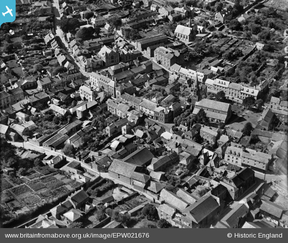
EPW021676 ENGLAND (1928). Fore Street and the town centre, Lostwithiel, 1928
© Copyright OpenStreetMap contributors and licensed by the OpenStreetMap Foundation. 2026. Cartography is licensed as CC BY-SA.
Nearby Images (11)
EPW021676

EPW054820

EPW033041

EPW054821

EPW033039

EPW021678

EPW054819

EPW021677

EPW033042

EPW033038

EPW033040

Details
| Title | [EPW021676] Fore Street and the town centre, Lostwithiel, 1928 |
| Reference | EPW021676 |
| Date | 24-June-1928 |
| Link | |
| Place name | LOSTWITHIEL |
| Parish | LOSTWITHIEL |
| District | |
| Country | ENGLAND |
| Easting / Northing | 210398, 59778 |
| Longitude / Latitude | -4.6686022497713, 50.406632521647 |
| National Grid Reference | SX104598 |
Pins

Class31 |
Friday 25th of April 2014 11:29:38 AM | |
|
Class31 |
Friday 25th of April 2014 11:26:39 AM | |
|
Class31 |
Thursday 26th of July 2012 09:55:02 AM | |
|
Class31 |
Thursday 26th of July 2012 09:53:46 AM | |
|
Class31 |
Thursday 26th of July 2012 09:53:27 AM | |
|
Class31 |
Thursday 26th of July 2012 09:53:09 AM | |
|
Class31 |
Thursday 26th of July 2012 09:52:30 AM |