
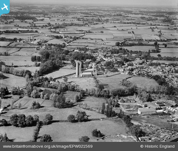
EPW021569 ENGLAND (1928). The Abbey Church of St Mary and St Thomas of Canterbury, Wymondham, from the south, 1928
© Copyright OpenStreetMap contributors and licensed by the OpenStreetMap Foundation. 2026. Cartography is licensed as CC BY-SA.
Nearby Images (3)
EPW021569

EPW039211

EPW039243

Details
| Title | [EPW021569] The Abbey Church of St Mary and St Thomas of Canterbury, Wymondham, from the south, 1928 |
| Reference | EPW021569 |
| Date | June-1928 |
| Link | |
| Place name | WYMONDHAM |
| Parish | WYMONDHAM |
| District | |
| Country | ENGLAND |
| Easting / Northing | 610625, 301234 |
| Longitude / Latitude | 1.1082356198191, 52.567726558671 |
| National Grid Reference | TG106012 |
Pins

John W |
Sunday 26th of April 2020 09:45:14 PM | |
|
John W |
Thursday 20th of October 2016 05:02:27 PM | |
|
John W |
Thursday 20th of October 2016 05:01:21 PM | |
|
Whittocks |
Saturday 14th of July 2012 06:40:47 PM |