
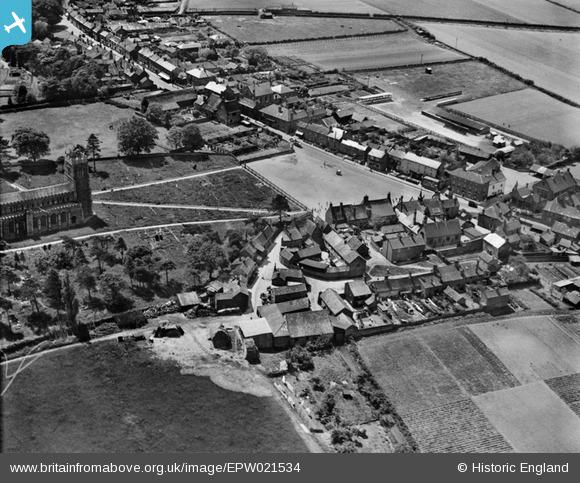
EPW021534 ENGLAND (1928). Church Plain and the High Street, Loddon, 1928
© Copyright OpenStreetMap contributors and licensed by the OpenStreetMap Foundation. 2026. Cartography is licensed as CC BY-SA.
Nearby Images (3)
EPW021534

EPW021535

EPW021536

Details
| Title | [EPW021534] Church Plain and the High Street, Loddon, 1928 |
| Reference | EPW021534 |
| Date | June-1928 |
| Link | |
| Place name | LODDON |
| Parish | LODDON |
| District | |
| Country | ENGLAND |
| Easting / Northing | 636267, 298770 |
| Longitude / Latitude | 1.4841659233428, 52.53508579727 |
| National Grid Reference | TM363988 |
Pins

GlenDenny53 |
Monday 9th of June 2014 11:15:18 AM | |
|
GlenDenny53 |
Monday 9th of June 2014 11:12:41 AM | |
|
GlenDenny53 |
Monday 9th of June 2014 11:09:26 AM | |
|
GlenDenny53 |
Monday 9th of June 2014 11:08:48 AM |