
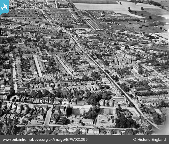
EPW021399 ENGLAND (1928). St Albans Road and Watford Junction, Watford, 1928
© Copyright OpenStreetMap contributors and licensed by the OpenStreetMap Foundation. 2026. Cartography is licensed as CC BY-SA.
Nearby Images (2)
EPW021399

EPW037384

Details
| Title | [EPW021399] St Albans Road and Watford Junction, Watford, 1928 |
| Reference | EPW021399 |
| Date | 30-May-1928 |
| Link | |
| Place name | WATFORD |
| Parish | |
| District | |
| Country | ENGLAND |
| Easting / Northing | 510690, 197238 |
| Longitude / Latitude | -0.39943518395912, 51.662543199522 |
| National Grid Reference | TQ107972 |
Pins
 |

Bluid |
Thursday 5th of November 2020 07:49:24 AM |
|
H.E. |
Wednesday 10th of April 2019 10:30:02 PM | |
|
H.E. |
Wednesday 10th of April 2019 10:27:45 PM | |
|
Peter B |
Friday 2nd of June 2017 09:49:09 PM | |
|
The Laird |
Saturday 11th of July 2015 01:55:17 PM | |
|
The Laird |
Saturday 11th of July 2015 01:50:46 PM | |
|
The Laird |
Saturday 11th of July 2015 01:47:49 PM | |
|
The Laird |
Saturday 11th of July 2015 01:39:10 PM | |
|
The Laird |
Saturday 11th of July 2015 01:35:23 PM | |
|
The Laird |
Saturday 11th of July 2015 01:29:25 PM | |
|
Brian |
Monday 29th of December 2014 10:33:09 PM | |
|
SheerFortitude |
Monday 11th of February 2013 02:06:24 PM |