
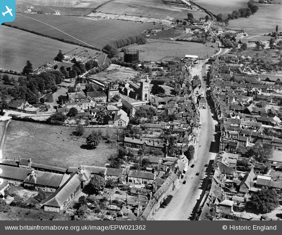
EPW021362 ENGLAND (1928). St Mary's Church and the High Street, Amersham, 1928
© Copyright OpenStreetMap contributors and licensed by the OpenStreetMap Foundation. 2026. Cartography is licensed as CC BY-SA.
Nearby Images (13)
EPW021362

EAW013623

EAW013620

EPW017835

EAW013622

EPW017831

EPW021361

EPW021359

EPW017830

EAW013619

EPW021360

EAW013618

EAW013621

Details
| Title | [EPW021362] St Mary's Church and the High Street, Amersham, 1928 |
| Reference | EPW021362 |
| Date | 27-May-1928 |
| Link | |
| Place name | AMERSHAM |
| Parish | AMERSHAM |
| District | |
| Country | ENGLAND |
| Easting / Northing | 495744, 197376 |
| Longitude / Latitude | -0.61544153326899, 51.666529632342 |
| National Grid Reference | SU957974 |
Pins

alastair wallace |
Sunday 20th of December 2015 11:13:17 PM | |
|
alastair wallace |
Sunday 20th of December 2015 11:12:36 PM |