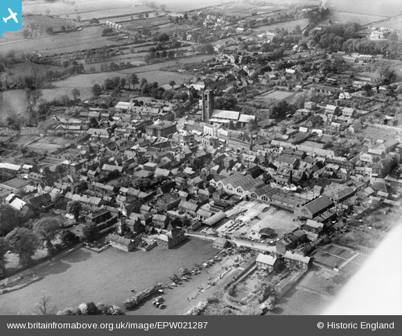
EPW021287 ENGLAND (1928). St Peter and St Paul's Church and the town, Fakenham, 1928
© Copyright OpenStreetMap contributors and licensed by the OpenStreetMap Foundation. 2025. Cartography is licensed as CC BY-SA.
Nearby Images (8)
Details
| Title | [EPW021287] St Peter and St Paul's Church and the town, Fakenham, 1928 |
| Reference | EPW021287 |
| Date | May-1928 |
| Link | |
| Place name | FAKENHAM |
| Parish | FAKENHAM |
| District | |
| Country | ENGLAND |
| Easting / Northing | 591973, 329615 |
| Longitude / Latitude | 0.84993395192959, 52.82947856145 |
| National Grid Reference | TF920296 |
Pins

Peter |
Friday 21st of February 2014 09:06:55 PM |


![[EPW021287] St Peter and St Paul's Church and the town, Fakenham, 1928](http://britainfromabove.org.uk/sites/all/libraries/aerofilms-images/public/100x100/EPW/021/EPW021287.jpg)
![[EPW021283] The Market Place and town centre, Fakenham, 1928](http://britainfromabove.org.uk/sites/all/libraries/aerofilms-images/public/100x100/EPW/021/EPW021283.jpg)
![[EPW021282] The Market Place and town centre, Fakenham, 1928](http://britainfromabove.org.uk/sites/all/libraries/aerofilms-images/public/100x100/EPW/021/EPW021282.jpg)
![[EPW021296] The town centre, Fakenham, 1928](http://britainfromabove.org.uk/sites/all/libraries/aerofilms-images/public/100x100/EPW/021/EPW021296.jpg)
![[EPW021286] The Market Place and town centre, Fakenham, 1928](http://britainfromabove.org.uk/sites/all/libraries/aerofilms-images/public/100x100/EPW/021/EPW021286.jpg)
![[EPW021284] St Peter and St Paul's Church, the Market Place and town centre, Fakenham, 1928](http://britainfromabove.org.uk/sites/all/libraries/aerofilms-images/public/100x100/EPW/021/EPW021284.jpg)
![[EPW021285] The Cattle Market and town centre, Fakenham, 1928](http://britainfromabove.org.uk/sites/all/libraries/aerofilms-images/public/100x100/EPW/021/EPW021285.jpg)
![[EPW021288] The Queen's Road school, Fakenham, 1928](http://britainfromabove.org.uk/sites/all/libraries/aerofilms-images/public/100x100/EPW/021/EPW021288.jpg)