
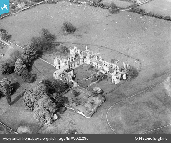
EPW021280 ENGLAND (1928). Castle Acre Priory, Castle Acre, 1928
© Copyright OpenStreetMap contributors and licensed by the OpenStreetMap Foundation. 2026. Cartography is licensed as CC BY-SA.
Nearby Images (11)
EPW021280

EPW021281

EAW014082

EAW014083

EAW014084

EPW021297

EAW014080

EPW021298

EAW014086

EAW014081

EAW014085

Details
| Title | [EPW021280] Castle Acre Priory, Castle Acre, 1928 |
| Reference | EPW021280 |
| Date | May-1928 |
| Link | |
| Place name | CASTLE ACRE |
| Parish | CASTLE ACRE |
| District | |
| Country | ENGLAND |
| Easting / Northing | 581417, 314802 |
| Longitude / Latitude | 0.68521694597433, 52.700104950471 |
| National Grid Reference | TF814148 |
Pins
Be the first to add a comment to this image!
User Comment Contributions
Monasteries were important buildings where monks and nuns lived a life of prayer and service to the local community. Most became ruins after the Dissolution of the Monasteries between 1524 and 1540. See more images of monasteries from the English Heritage Archive collections on Heritage Explorer http://www.heritage-explorer.co.uk/web/he/imagebytheme.aspx?ctid=12 |

MM |
Thursday 21st of March 2013 10:17:51 AM |