
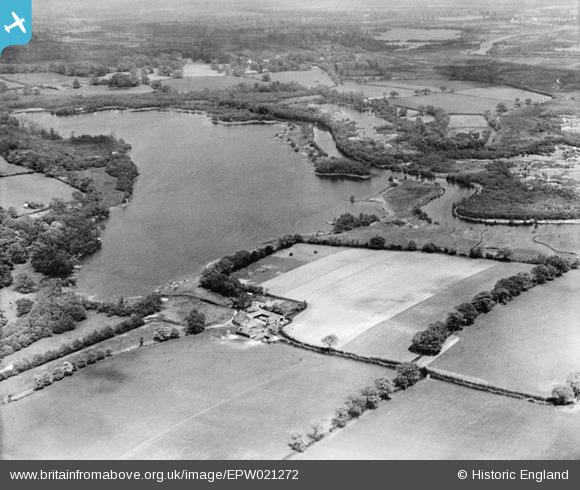
EPW021272 ENGLAND (1928). Wroxham Broad, Wroxham, from the south-west, 1928
© Copyright OpenStreetMap contributors and licensed by the OpenStreetMap Foundation. 2026. Cartography is licensed as CC BY-SA.
Nearby Images (3)
EPW021272

EPW021269

EPW059161

Details
| Title | [EPW021272] Wroxham Broad, Wroxham, from the south-west, 1928 |
| Reference | EPW021272 |
| Date | May-1928 |
| Link | |
| Place name | WROXHAM |
| Parish | SALHOUSE |
| District | |
| Country | ENGLAND |
| Easting / Northing | 630624, 316188 |
| Longitude / Latitude | 1.4132614572948, 52.693828752385 |
| National Grid Reference | TG306162 |
Pins
Be the first to add a comment to this image!