
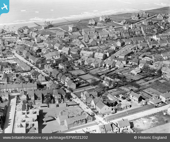
EPW021202 ENGLAND (1928). Cremer Street and environs, Sheringham, 1928
© Copyright OpenStreetMap contributors and licensed by the OpenStreetMap Foundation. 2026. Cartography is licensed as CC BY-SA.
Nearby Images (7)
EPW021202

EPW016557

EAW038318

EPW016556

EPW016556
EPW016558

EAW051653

Details
| Title | [EPW021202] Cremer Street and environs, Sheringham, 1928 |
| Reference | EPW021202 |
| Date | May-1928 |
| Link | |
| Place name | SHERINGHAM |
| Parish | SHERINGHAM |
| District | |
| Country | ENGLAND |
| Easting / Northing | 616051, 343214 |
| Longitude / Latitude | 1.2158349589347, 52.942434371151 |
| National Grid Reference | TG161432 |
Pins

Crimps13 |
Saturday 16th of October 2021 02:38:06 PM | |
|
Chris Booty |
Wednesday 18th of April 2018 05:13:37 PM | |
|
Chris Booty |
Wednesday 18th of April 2018 05:13:01 PM | |
|
Chris Booty |
Wednesday 18th of April 2018 05:12:23 PM | |
|
Chris Booty |
Wednesday 18th of April 2018 05:10:52 PM | |
|
Chris Booty |
Wednesday 18th of April 2018 05:07:25 PM | |
|
Farrowbee |
Tuesday 24th of March 2015 07:17:13 PM | |
|
Farrowbee |
Tuesday 24th of March 2015 06:18:57 PM | |
|
Farrowbee |
Tuesday 24th of March 2015 06:15:59 PM | |
|
Farrowbee |
Tuesday 24th of March 2015 06:15:09 PM |
User Comment Contributions
The co-op |
Farrowbee |
Tuesday 24th of March 2015 06:18:13 PM |