
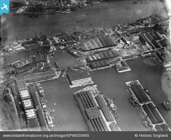
EPW020965 ENGLAND (1928). West India Docks, Blackwall, 1928
© Copyright OpenStreetMap contributors and licensed by the OpenStreetMap Foundation. 2026. Cartography is licensed as CC BY-SA.
Nearby Images (6)
EPW020965

EAW130034

EPW024256

EAW687121

EAW000647

EAW029487

Details
| Title | [EPW020965] West India Docks, Blackwall, 1928 |
| Reference | EPW020965 |
| Date | April-1928 |
| Link | |
| Place name | BLACKWALL |
| Parish | |
| District | |
| Country | ENGLAND |
| Easting / Northing | 538031, 180184 |
| Longitude / Latitude | -0.011024716126339, 51.503229053723 |
| National Grid Reference | TQ380802 |
Pins

yes |
Friday 17th of May 2024 07:20:23 PM |
User Comment Contributions
worked there in the sixtys |
don31142 |
Wednesday 10th of October 2012 10:53:16 PM |