
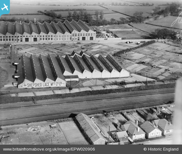
EPW020906 ENGLAND (1928). The Shepshed Lace Company Works, Loughborough, 1928
© Copyright OpenStreetMap contributors and licensed by the OpenStreetMap Foundation. 2026. Cartography is licensed as CC BY-SA.
Nearby Images (7)
EPW020906

EPW020910

EPW020908

EPW020905

EPW020904

EPW020909

EPW020907

Details
| Title | [EPW020906] The Shepshed Lace Company Works, Loughborough, 1928 |
| Reference | EPW020906 |
| Date | April-1928 |
| Link | |
| Place name | LOUGHBOROUGH |
| Parish | |
| District | |
| Country | ENGLAND |
| Easting / Northing | 454403, 319185 |
| Longitude / Latitude | -1.1935962380438, 52.767183286207 |
| National Grid Reference | SK544192 |
Pins

John Wass |
Tuesday 10th of February 2015 04:27:03 PM |
User Comment Contributions
The factory at the top is all but demolished, just the front wall standing with Morris waste using the land. |
Penzo |
Tuesday 25th of June 2013 08:37:32 PM |