
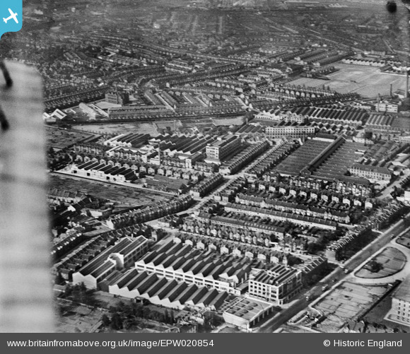
EPW020854 ENGLAND (1928). Engineering Works and Motor Coach Works on Warple Way, Acton, from the north-east, 1928
© Copyright OpenStreetMap contributors and licensed by the OpenStreetMap Foundation. 2026. Cartography is licensed as CC BY-SA.
Nearby Images (19)
EPW020854

EPW020851

EPW020216

EPW020216
EPW020217

EPW020217
EPW020215

EPW020853

EPW020218

EPW020218
EPW020219

EPW020219
EPW020855

EPW062165

EPW062164

EPW062159

EPW005201

EAW031005

EAW031006

Details
| Title | [EPW020854] Engineering Works and Motor Coach Works on Warple Way, Acton, from the north-east, 1928 |
| Reference | EPW020854 |
| Date | April-1928 |
| Link | |
| Place name | ACTON |
| Parish | |
| District | |
| Country | ENGLAND |
| Easting / Northing | 521519, 179931 |
| Longitude / Latitude | -0.24891602470771, 51.504747424163 |
| National Grid Reference | TQ215799 |
Pins

steve |
Wednesday 17th of July 2019 11:28:46 PM | |
|
Leslie B |
Saturday 26th of March 2016 11:57:56 PM | |
|
totoro |
Sunday 19th of January 2014 06:39:58 PM | |
|
totoro |
Sunday 19th of January 2014 06:27:48 PM | |
|
totoro |
Sunday 19th of January 2014 06:27:03 PM | |
|
totoro |
Sunday 19th of January 2014 06:26:45 PM | |
|
totoro |
Sunday 19th of January 2014 06:23:33 PM | |
|
totoro |
Sunday 19th of January 2014 06:22:44 PM | |
|
totoro |
Sunday 19th of January 2014 06:21:38 PM |