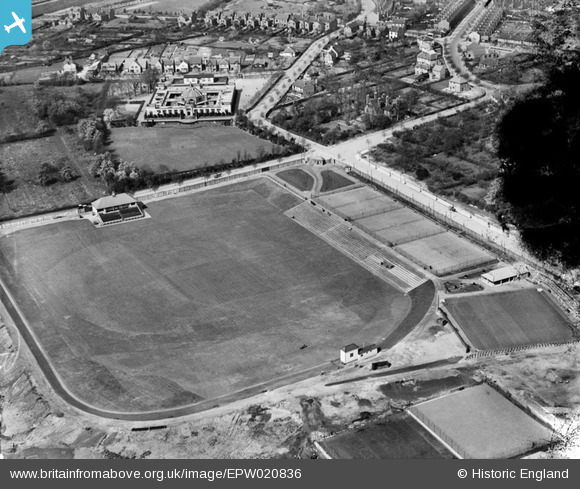
EPW020836 ENGLAND (1928). Rutland Recreation Ground, Ilkeston, 1928
© Copyright OpenStreetMap contributors and licensed by the OpenStreetMap Foundation. 2025. Cartography is licensed as CC BY-SA.
Details
| Title | [EPW020836] Rutland Recreation Ground, Ilkeston, 1928 |
| Reference | EPW020836 |
| Date | April-1928 |
| Link | |
| Place name | ILKESTON |
| Parish | |
| District | |
| Country | ENGLAND |
| Easting / Northing | 446060, 341633 |
| Longitude / Latitude | -1.3140764772591, 52.969761812826 |
| National Grid Reference | SK461416 |
Pins

beverley4499 |
Monday 22nd of October 2012 04:33:24 PM | |

beverley4499 |
Monday 22nd of October 2012 04:32:07 PM | |

Class31 |
Thursday 4th of October 2012 12:26:34 PM | |

Class31 |
Thursday 4th of October 2012 12:25:58 PM | |

Class31 |
Thursday 4th of October 2012 12:16:02 PM | |

Class31 |
Thursday 4th of October 2012 12:15:12 PM | |

Class31 |
Thursday 4th of October 2012 12:14:38 PM | |

Class31 |
Thursday 4th of October 2012 12:14:05 PM | |

Class31 |
Thursday 4th of October 2012 12:13:21 PM |


![[EPW020836] Rutland Recreation Ground, Ilkeston, 1928](http://britainfromabove.org.uk/sites/all/libraries/aerofilms-images/public/100x100/EPW/020/EPW020836.jpg)
![[EPW020829] Ilkeston School, Ilkeston, 1928](http://britainfromabove.org.uk/sites/all/libraries/aerofilms-images/public/100x100/EPW/020/EPW020829.jpg)