
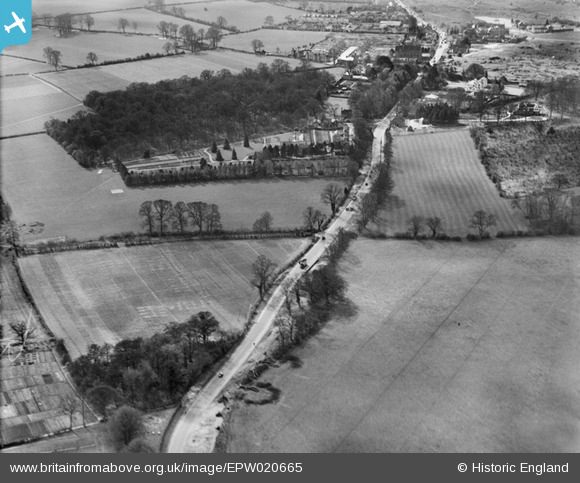
EPW020665 ENGLAND (1928). The Brighton Road (A217), Burgh Heath, 1928
© Copyright OpenStreetMap contributors and licensed by the OpenStreetMap Foundation. 2026. Cartography is licensed as CC BY-SA.
Nearby Images (2)
EPW020665
, Burgh Heath, 1928")
EPW020660
 to the south of Banstead, Burgh Heath, 1928")
Details
| Title | [EPW020665] The Brighton Road (A217), Burgh Heath, 1928 |
| Reference | EPW020665 |
| Date | March-1928 |
| Link | |
| Place name | BURGH HEATH |
| Parish | |
| District | |
| Country | ENGLAND |
| Easting / Northing | 524595, 158503 |
| Longitude / Latitude | -0.21214332410621, 51.31147733665 |
| National Grid Reference | TQ246585 |
Pins

crepello |
Tuesday 16th of February 2016 01:38:28 AM | |
|
crepello |
Tuesday 16th of February 2016 01:33:10 AM | |
|
crepello |
Monday 15th of February 2016 11:06:54 PM | |
|
crepello |
Monday 15th of February 2016 10:55:59 PM | |
|
crepello |
Monday 15th of February 2016 10:49:21 PM | |
|
crepello |
Monday 15th of February 2016 10:45:46 PM | |
|
crepello |
Monday 15th of February 2016 10:43:11 PM | |
|
crepello |
Monday 15th of February 2016 10:28:41 PM | |
|
christhewino |
Friday 28th of December 2012 12:13:52 PM |