
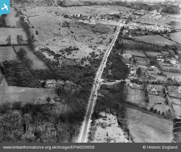
EPW020658 ENGLAND (1928). The Brighton Road (A217), Burgh Heath, 1928
© Copyright OpenStreetMap contributors and licensed by the OpenStreetMap Foundation. 2026. Cartography is licensed as CC BY-SA.
Nearby Images (4)
EPW020658
, Burgh Heath, 1928")
EPW020659
, Burgh Heath, 1928")
EPW020663
, Burgh Heath, 1928")
EPW020664
, Burgh Heath, 1928")
Details
| Title | [EPW020658] The Brighton Road (A217), Burgh Heath, 1928 |
| Reference | EPW020658 |
| Date | March-1928 |
| Link | |
| Place name | BURGH HEATH |
| Parish | |
| District | |
| Country | ENGLAND |
| Easting / Northing | 524074, 157160 |
| Longitude / Latitude | -0.22008261437001, 51.299519692098 |
| National Grid Reference | TQ241572 |
Pins
Be the first to add a comment to this image!