
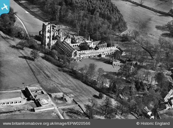
EPW020566 ENGLAND (1928). The Abbey Ruins, Fountains Abbey, 1928
© Copyright OpenStreetMap contributors and licensed by the OpenStreetMap Foundation. 2026. Cartography is licensed as CC BY-SA.
Nearby Images (6)
EPW020566

EAW009248

EAW009247

EAW009246

EAW009245

EPW020567

Details
| Title | [EPW020566] The Abbey Ruins, Fountains Abbey, 1928 |
| Reference | EPW020566 |
| Date | March-1928 |
| Link | |
| Place name | FOUNTAINS ABBEY |
| Parish | LINDRICK WITH STUDLEY ROYAL AND FOUNTAINS |
| District | |
| Country | ENGLAND |
| Easting / Northing | 427418, 468278 |
| Longitude / Latitude | -1.5805782183036, 54.109472497462 |
| National Grid Reference | SE274683 |
Pins
Be the first to add a comment to this image!