
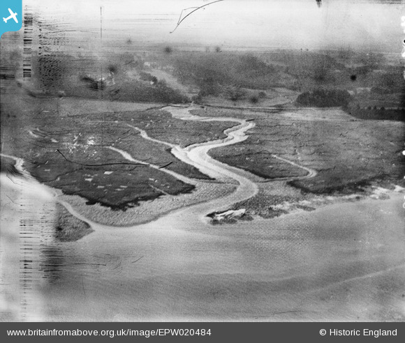
EPW020484 ENGLAND (1928). Southampton Water mud flats and Cadland Creek, Fawley, from the north-east, 1928
© Copyright OpenStreetMap contributors and licensed by the OpenStreetMap Foundation. 2026. Cartography is licensed as CC BY-SA.
Nearby Images (4)
EPW020484

EPW020514

EPW020472

EPW020491

Details
| Title | [EPW020484] Southampton Water mud flats and Cadland Creek, Fawley, from the north-east, 1928 |
| Reference | EPW020484 |
| Date | 16-March-1928 |
| Link | |
| Place name | FAWLEY |
| Parish | FAWLEY |
| District | |
| Country | ENGLAND |
| Easting / Northing | 445772, 105598 |
| Longitude / Latitude | -1.3497581481374, 50.84753084478 |
| National Grid Reference | SU458056 |
Pins
Be the first to add a comment to this image!