
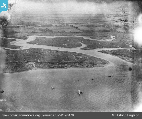
EPW020479 ENGLAND (1928). Southampton Water mud flats and Ower Lake, Calshot, from the north-east, 1928
© Copyright OpenStreetMap contributors and licensed by the OpenStreetMap Foundation. 2026. Cartography is licensed as CC BY-SA.
Nearby Images (3)
EPW020479

EPW020510

EPW020509

Details
| Title | [EPW020479] Southampton Water mud flats and Ower Lake, Calshot, from the north-east, 1928 |
| Reference | EPW020479 |
| Date | 16-March-1928 |
| Link | |
| Place name | CALSHOT |
| Parish | FAWLEY |
| District | |
| Country | ENGLAND |
| Easting / Northing | 448540, 102703 |
| Longitude / Latitude | -1.3108221350068, 50.821270751515 |
| National Grid Reference | SU485027 |
Pins

Class31 |
Tuesday 7th of August 2012 08:17:40 PM |