
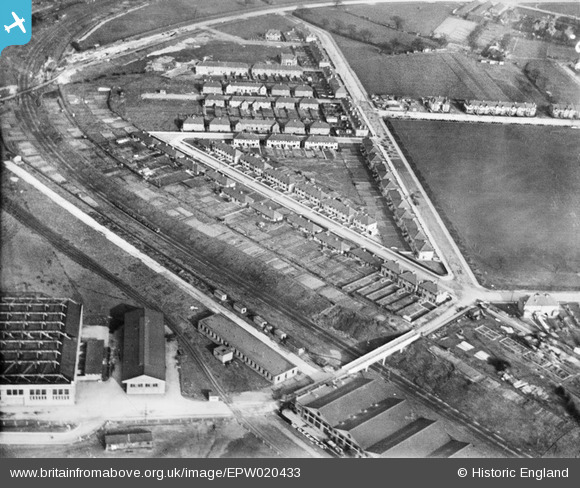
EPW020433 ENGLAND (1928). Housing development around Northfields Road, Acton, 1928
© Copyright OpenStreetMap contributors and licensed by the OpenStreetMap Foundation. 2026. Cartography is licensed as CC BY-SA.
Nearby Images (14)
EPW020433

EPW020434

EPW058337

EPW020344

EPW020344
EPW046984

EPW046982

EPW046983

EPW046981

EPW032154

EPW046985

EPW046980

EPW046986

EPW046987

Details
| Title | [EPW020433] Housing development around Northfields Road, Acton, 1928 |
| Reference | EPW020433 |
| Date | March-1928 |
| Link | |
| Place name | ACTON |
| Parish | |
| District | |
| Country | ENGLAND |
| Easting / Northing | 519937, 181878 |
| Longitude / Latitude | -0.2710387678562, 51.522585839358 |
| National Grid Reference | TQ199819 |
Pins
Be the first to add a comment to this image!