
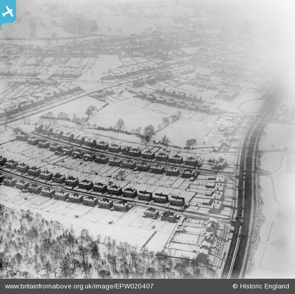
EPW020407 ENGLAND (1928). Housing in the snow around Dobcroft Road, Millhouses, 1928
© Copyright OpenStreetMap contributors and licensed by the OpenStreetMap Foundation. 2026. Cartography is licensed as CC BY-SA.
Nearby Images (6)
EPW020407

EPW020409

EAW031278

EAW031277

EAW031276

EAW031275

Details
| Title | [EPW020407] Housing in the snow around Dobcroft Road, Millhouses, 1928 |
| Reference | EPW020407 |
| Date | March-1928 |
| Link | |
| Place name | MILLHOUSES |
| Parish | |
| District | |
| Country | ENGLAND |
| Easting / Northing | 433126, 382986 |
| Longitude / Latitude | -1.5023995855291, 53.342465835581 |
| National Grid Reference | SK331830 |
Pins
Be the first to add a comment to this image!
User Comment Contributions
In the late 1920s and 30s many towns were expanding in to the countryside around as inner city slums were demolished and people needed to be rehoused. These semi detached houses in Sheffield, with long gardens, are typical of the planned new housing estates of this period. The snow is melting in interesting patterns on the roofs of the houses. |

MM |
Thursday 31st of October 2013 12:31:22 PM |