
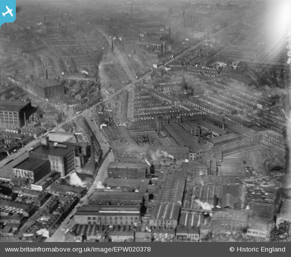
EPW020378 ENGLAND (1928). The area around Blackburn Road and Kay Road, Bolton, 1928
© Copyright OpenStreetMap contributors and licensed by the OpenStreetMap Foundation. 2026. Cartography is licensed as CC BY-SA.
Nearby Images (8)
EPW020378

EPW020376

EPW020380

EPW020373

EPW020374

EPW020379

EPW020375

EPW020377

Details
| Title | [EPW020378] The area around Blackburn Road and Kay Road, Bolton, 1928 |
| Reference | EPW020378 |
| Date | March-1928 |
| Link | |
| Place name | BOLTON |
| Parish | |
| District | |
| Country | ENGLAND |
| Easting / Northing | 371728, 410145 |
| Longitude / Latitude | -2.4271323765779, 53.586887054708 |
| National Grid Reference | SD717101 |
Pins

dave44 |
Friday 5th of January 2024 03:28:06 PM | |
|
Carol AFGW |
Sunday 11th of February 2018 12:25:36 PM | |
|
Carol AFGW |
Sunday 11th of February 2018 12:22:52 PM | |
|
IanB |
Tuesday 30th of January 2018 09:07:14 PM | |

Class31 |
Wednesday 4th of May 2016 08:15:05 AM | |
|
Class31 |
Wednesday 4th of May 2016 08:12:25 AM | |
|
schofield |
Sunday 16th of March 2014 12:30:49 AM | |
|
BlindBilly148 |
Sunday 1st of September 2013 10:16:09 AM | |
|
copper |
Wednesday 19th of June 2013 01:35:19 AM | |
|
copper |
Wednesday 19th of June 2013 01:33:29 AM | |
|
jmarlor |
Thursday 9th of May 2013 05:20:30 PM | |
|
jmarlor |
Thursday 9th of May 2013 05:19:22 PM | |
|
jmarlor |
Thursday 9th of May 2013 05:18:31 PM |

User Comment Contributions
My Wife says the Church is St Georges |
copper |
Tuesday 11th of February 2014 08:46:21 PM |
It is Saint James Church I was Christened there and lived at the bottom of Waterloo Street. |
ALAN |
Tuesday 11th of February 2014 08:46:21 PM |
St James the Apostle Church, Waterloo St, not St Georges Church |
BlindBilly148 |
Sunday 1st of September 2013 10:13:21 AM |
it isnt Kay Road, it is Kay st ! |
rhianne2003 |
Friday 29th of June 2012 08:34:26 AM |