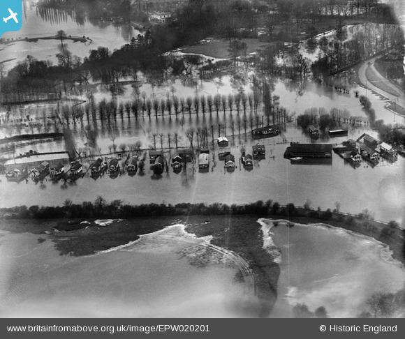
EPW020201 ENGLAND (1928). Flooding around Sandhills Meadow, Shepperton, 1928
© Copyright OpenStreetMap contributors and licensed by the OpenStreetMap Foundation. 2025. Cartography is licensed as CC BY-SA.
Nearby Images (5)
Details
| Title | [EPW020201] Flooding around Sandhills Meadow, Shepperton, 1928 |
| Reference | EPW020201 |
| Date | 3-January-1928 |
| Link | |
| Place name | SHEPPERTON |
| Parish | |
| District | |
| Country | ENGLAND |
| Easting / Northing | 508364, 166669 |
| Longitude / Latitude | -0.44246104618445, 51.388208162396 |
| National Grid Reference | TQ084667 |
Pins
Be the first to add a comment to this image!


![[EPW020201] Flooding around Sandhills Meadow, Shepperton, 1928](http://britainfromabove.org.uk/sites/all/libraries/aerofilms-images/public/100x100/EPW/020/EPW020201.jpg)
![[EPW023503] The River Thames and Chertsey Road, Shepperton, 1928](http://britainfromabove.org.uk/sites/all/libraries/aerofilms-images/public/100x100/EPW/023/EPW023503.jpg)
![[EPW023497] Chertsey Road, Shepperton, 1928](http://britainfromabove.org.uk/sites/all/libraries/aerofilms-images/public/100x100/EPW/023/EPW023497.jpg)
![[EPW043786] Lower Halliford, Shepperton and the Queen Mary Reservoir, Shepperton, from the south-east, 1934](http://britainfromabove.org.uk/sites/all/libraries/aerofilms-images/public/100x100/EPW/043/EPW043786.jpg)