
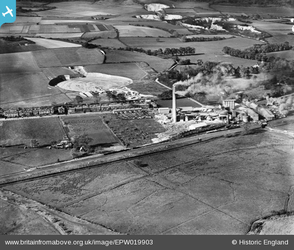
EPW019903 ENGLAND (1927). Holborough Cement Works and Quarry, Holborough, 1927
© Copyright OpenStreetMap contributors and licensed by the OpenStreetMap Foundation. 2026. Cartography is licensed as CC BY-SA.
Nearby Images (18)
EPW019903

EPW019902

EPW019901

EPW020919

EPW020918

EPW020921

EPW019912

EPW020922

EPW019907

EPW020925

EPW020923

EPW020920

EPW019911

EPW020924

EPW019909

EPW019908

EPW019904

EPW019906

Details
| Title | [EPW019903] Holborough Cement Works and Quarry, Holborough, 1927 |
| Reference | EPW019903 |
| Date | October-1927 |
| Link | |
| Place name | HOLBOROUGH |
| Parish | SNODLAND |
| District | |
| Country | ENGLAND |
| Easting / Northing | 570481, 162490 |
| Longitude / Latitude | 0.44764015213608, 51.335402719168 |
| National Grid Reference | TQ705625 |
Pins

slumpy |
Thursday 18th of April 2024 01:21:28 PM | |
|
slumpy |
Thursday 18th of April 2024 01:20:54 PM | |
|
slumpy |
Thursday 18th of April 2024 01:19:52 PM | |
|
slumpy |
Thursday 18th of April 2024 01:19:35 PM | |
|
slumpy |
Thursday 18th of April 2024 01:19:00 PM | |
|
slumpy |
Thursday 18th of April 2024 01:18:38 PM | |

Dylan Moore |
Tuesday 16th of October 2012 12:15:23 PM | |
|
Dylan Moore |
Tuesday 16th of October 2012 12:14:15 PM |
User Comment Contributions
For details, history and many links, see [[http://www.cementkilns.co.uk/cement_kiln_holborough.html]]. |
Dylan Moore |
Thursday 18th of October 2012 09:30:59 PM |

Holborough |
Dylan Moore |
Tuesday 16th of October 2012 07:04:10 PM |
Picture of Holborough Cement Plant just before its acquisition by the Red Triangle Group. The plant operated 1924-1984. The third kiln had been installed the previous year. |
Dylan Moore |
Tuesday 16th of October 2012 12:33:34 PM |