
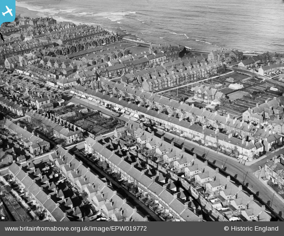
EPW019772 ENGLAND (1927). The Whitley and Delaval Roads and environs, Whitley Bay, 1927
© Copyright OpenStreetMap contributors and licensed by the OpenStreetMap Foundation. 2026. Cartography is licensed as CC BY-SA.
Nearby Images (3)
EPW019772

EPW019765

EPW025031

Details
| Title | [EPW019772] The Whitley and Delaval Roads and environs, Whitley Bay, 1927 |
| Reference | EPW019772 |
| Date | 18-October-1927 |
| Link | |
| Place name | WHITLEY BAY |
| Parish | |
| District | |
| Country | ENGLAND |
| Easting / Northing | 436063, 571823 |
| Longitude / Latitude | -1.4356256174128, 55.039542026311 |
| National Grid Reference | NZ361718 |
Pins

cheviotwalks |
Wednesday 15th of October 2014 11:23:10 PM | |
|
WHITLEY13 |
Sunday 24th of February 2013 10:36:08 PM | |

Class31 |
Monday 21st of January 2013 05:10:29 PM | |
|
Class31 |
Monday 21st of January 2013 05:09:56 PM | |
|
Class31 |
Monday 21st of January 2013 05:09:27 PM |
User Comment Contributions
Does anyone have any pictures or info on a shop possibly a sweet shop that used to be on egremont place? |
WHITLEY13 |
Tuesday 19th of November 2013 02:14:58 PM |
The index to the photograph collection at Discover North Tyneside does not include Egremont Place. Ward's Directory for 1928 includes a Mrs M. Lawton, general dealer, 1 Egremont Place. Was the shop contemporary with the Aerofilms view ? |
Eric Hollerton |
Tuesday 19th of November 2013 02:14:58 PM |