
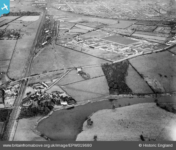
EPW019680 ENGLAND (1927). The Branston Artificial Silk Works (formerly the Branston Food Preserve Works), Branston, 1927
© Copyright OpenStreetMap contributors and licensed by the OpenStreetMap Foundation. 2026. Cartography is licensed as CC BY-SA.
Nearby Images (2)
EPW019680
, Branston, 1927")
EPW019681
, Branston, 1927")
Details
| Title | [EPW019680] The Branston Artificial Silk Works (formerly the Branston Food Preserve Works), Branston, 1927 |
| Reference | EPW019680 |
| Date | October-1927 |
| Link | |
| Place name | BRANSTON |
| Parish | BRANSTON |
| District | |
| Country | ENGLAND |
| Easting / Northing | 422934, 321160 |
| Longitude / Latitude | -1.6599008693205, 52.787192805852 |
| National Grid Reference | SK229212 |
Pins
Be the first to add a comment to this image!
User Comment Contributions
middle of picture running L-R is Burton Road with what is Warren Lane running down towards the bottom Left of picture. The river bend at bottom of picture is far wider than it is today |

CameraKev |
Thursday 18th of April 2013 10:30:01 PM |