
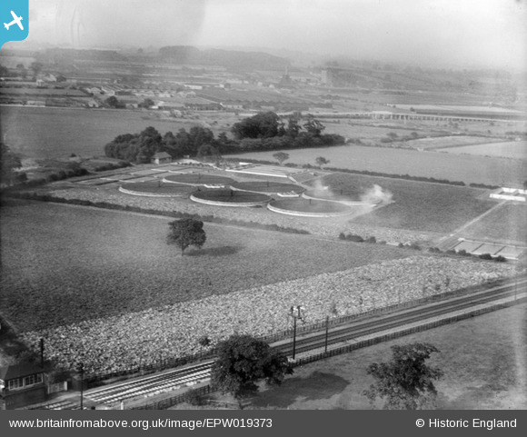
EPW019373 ENGLAND (1927). The Long Eaton Urban District Council Sewage Works, Attenborough, 1927
© Copyright OpenStreetMap contributors and licensed by the OpenStreetMap Foundation. 2025. Cartography is licensed as CC BY-SA.
Nearby Images (4)
EPW019373

EPW019375

EPW019371

EPW019372

Details
| Title | [EPW019373] The Long Eaton Urban District Council Sewage Works, Attenborough, 1927 |
| Reference | EPW019373 |
| Date | 26-September-1927 |
| Link | |
| Place name | ATTENBOROUGH |
| Parish | |
| District | |
| Country | ENGLAND |
| Easting / Northing | 450871, 333829 |
| Longitude / Latitude | -1.2436618850484, 52.899172564178 |
| National Grid Reference | SK509338 |
Pins
Be the first to add a comment to this image!