
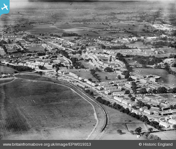
EPW019313 ENGLAND (1927). New housing next to the London Aerodrome, Burnt Oak, from the east, 1927
© Copyright OpenStreetMap contributors and licensed by the OpenStreetMap Foundation. 2026. Cartography is licensed as CC BY-SA.
Nearby Images (2)
EPW019313

EPW019312

Details
| Title | [EPW019313] New housing next to the London Aerodrome, Burnt Oak, from the east, 1927 |
| Reference | EPW019313 |
| Date | 23-September-1927 |
| Link | |
| Place name | BURNT OAK |
| Parish | |
| District | |
| Country | ENGLAND |
| Easting / Northing | 520868, 190976 |
| Longitude / Latitude | -0.25449542479364, 51.60416234002 |
| National Grid Reference | TQ209910 |
