
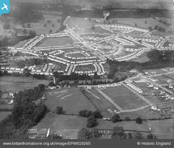
EPW019265 ENGLAND (1927). Sea Mills Garden Suburb, Sea Mills, 1927
© Copyright OpenStreetMap contributors and licensed by the OpenStreetMap Foundation. 2025. Cartography is licensed as CC BY-SA.
Nearby Images (2)
EPW019265

EPW019266

Details
| Title | [EPW019265] Sea Mills Garden Suburb, Sea Mills, 1927 |
| Reference | EPW019265 |
| Date | 1-September-1927 |
| Link | |
| Place name | SEA MILLS |
| Parish | |
| District | |
| Country | ENGLAND |
| Easting / Northing | 355315, 176498 |
| Longitude / Latitude | -2.6436140205874, 51.485181292445 |
| National Grid Reference | ST553765 |
Pins

Class31 |
Monday 6th of August 2012 04:12:00 PM | |
|
Class31 |
Monday 6th of August 2012 04:11:04 PM | |
|
Class31 |
Monday 6th of August 2012 04:10:04 PM | |
|
Class31 |
Monday 6th of August 2012 04:08:47 PM | |
|
Class31 |
Monday 6th of August 2012 04:08:13 PM | |
|
Class31 |
Monday 6th of August 2012 04:07:19 PM | |
|
Class31 |
Monday 6th of August 2012 04:06:35 PM |