
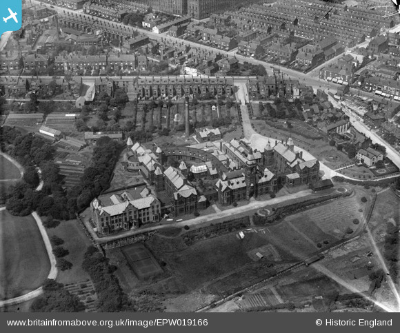
EPW019166 ENGLAND (1927). The Bolton Infirmary, Bolton, 1927
© Copyright OpenStreetMap contributors and licensed by the OpenStreetMap Foundation. 2026. Cartography is licensed as CC BY-SA.
Nearby Images (11)
EPW019166

EPW019167

EPW019169

EPW019162

EPW019165

EPW019168

EPW019164

EPW019163

EAW047049

EAW047046

EAW047044

Details
| Title | [EPW019166] The Bolton Infirmary, Bolton, 1927 |
| Reference | EPW019166 |
| Date | August-1927 |
| Link | |
| Place name | BOLTON |
| Parish | |
| District | |
| Country | ENGLAND |
| Easting / Northing | 370910, 409476 |
| Longitude / Latitude | -2.4394279185841, 53.580828613761 |
| National Grid Reference | SD709095 |
