
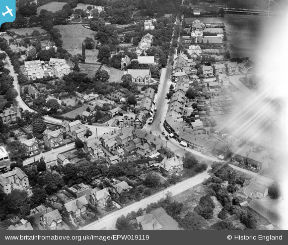
EPW019119 ENGLAND (1927). Bramhall Lane, Bramhall, 1927
© Copyright OpenStreetMap contributors and licensed by the OpenStreetMap Foundation. 2026. Cartography is licensed as CC BY-SA.
Nearby Images (2)
EPW019119

EPW017459

Details
| Title | [EPW019119] Bramhall Lane, Bramhall, 1927 |
| Reference | EPW019119 |
| Date | 4-August-1927 |
| Link | |
| Place name | BRAMHALL |
| Parish | |
| District | |
| Country | ENGLAND |
| Easting / Northing | 389050, 384531 |
| Longitude / Latitude | -2.1645413338146, 53.35727887487 |
| National Grid Reference | SJ891845 |
Pins

John Ellis |
Thursday 1st of September 2016 09:50:02 PM | |
|
John Ellis |
Thursday 1st of September 2016 09:47:40 PM | |
|
John Ellis |
Thursday 1st of September 2016 09:46:24 PM | |
|
John Ellis |
Thursday 1st of September 2016 09:45:17 PM | |
|
John Ellis |
Thursday 1st of September 2016 09:43:19 PM | |
|
John Ellis |
Thursday 1st of September 2016 09:39:12 PM | |
|
Jabezlad |
Tuesday 11th of December 2012 03:03:57 PM | |
|
Anita Jones |
Monday 2nd of July 2012 06:40:14 PM | |
|
Anita Jones |
Monday 2nd of July 2012 06:39:04 PM | |
|
Anita Jones |
Monday 2nd of July 2012 06:35:38 PM |