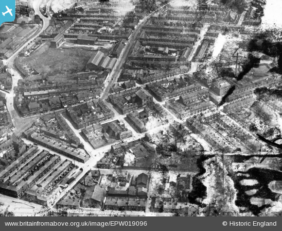
EPW019096 ENGLAND (1927). Travis Street, Mottram Road and environs, Hyde, 1927. This image has been produced from a damaged print.
© Copyright OpenStreetMap contributors and licensed by the OpenStreetMap Foundation. 2026. Cartography is licensed as CC BY-SA.
Details
| Title | [EPW019096] Travis Street, Mottram Road and environs, Hyde, 1927. This image has been produced from a damaged print. |
| Reference | EPW019096 |
| Date | 4-August-1927 |
| Link | |
| Place name | HYDE |
| Parish | |
| District | |
| Country | ENGLAND |
| Easting / Northing | 395097, 394887 |
| Longitude / Latitude | -2.0738365872791, 53.450465836855 |
| National Grid Reference | SJ951949 |
Pins

buryblackpud |
Thursday 5th of October 2023 02:08:54 PM | |

manutdmrs |
Thursday 24th of February 2022 11:01:55 PM | |

Les H |
Thursday 19th of May 2016 12:00:27 PM | |

Les H |
Thursday 19th of May 2016 11:58:44 AM | |

Les H |
Thursday 19th of May 2016 11:55:24 AM | |

Les H |
Thursday 19th of May 2016 11:54:13 AM | |

Les H |
Thursday 19th of May 2016 11:53:22 AM | |

Les H |
Thursday 19th of May 2016 11:52:20 AM | |

manutdmrs |
Friday 9th of October 2015 09:59:34 PM | |

stardelta |
Wednesday 29th of October 2014 09:16:33 PM | |

stardelta |
Wednesday 29th of October 2014 09:15:47 PM |


![[EPW019096] Travis Street, Mottram Road and environs, Hyde, 1927. This image has been produced from a damaged print.](http://britainfromabove.org.uk/sites/all/libraries/aerofilms-images/public/100x100/EPW/019/EPW019096.jpg)
![[EPW019097] The town centre, Hyde, 1927. This image has been produced from a copy-negative.](http://britainfromabove.org.uk/sites/all/libraries/aerofilms-images/public/100x100/EPW/019/EPW019097.jpg)
![[EPW019095] The Market Place and environs, Hyde, 1927. This image has been produced from a copy-negative.](http://britainfromabove.org.uk/sites/all/libraries/aerofilms-images/public/100x100/EPW/019/EPW019095.jpg)