
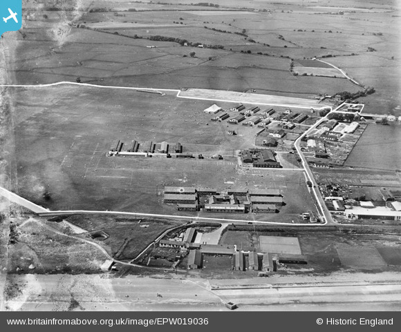
EPW019036 ENGLAND (1927). Dymchurch Holiday Camp, St Mary's Bay, 1927
© Copyright OpenStreetMap contributors and licensed by the OpenStreetMap Foundation. 2026. Cartography is licensed as CC BY-SA.
Nearby Images (8)
EPW019036

EPW019037

EPW019043

EPW035392
, St Mary's Bay, 1931")
EPW019039

EPW035401
 and Littlestone Aerodrome, St Mary's Bay, from the south-east, 1931")
EPW035400
, St Mary's Bay, 1931")
EPW019035

Details
| Title | [EPW019036] Dymchurch Holiday Camp, St Mary's Bay, 1927 |
| Reference | EPW019036 |
| Date | 3-August-1927 |
| Link | |
| Place name | ST MARY'S BAY |
| Parish | ST. MARY IN THE MARSH |
| District | |
| Country | ENGLAND |
| Easting / Northing | 608871, 127460 |
| Longitude / Latitude | 0.97773529025104, 51.008001277247 |
| National Grid Reference | TR089275 |
Pins

Glassblower |
Sunday 27th of November 2016 01:39:34 AM | |
|
Glassblower |
Sunday 27th of November 2016 01:37:28 AM | |
|
Glassblower |
Sunday 27th of November 2016 01:36:43 AM | |
|
Glassblower |
Sunday 27th of November 2016 01:33:10 AM | |
|
Glassblower |
Sunday 27th of November 2016 01:28:52 AM | |
|
Paolo |
Monday 3rd of December 2012 03:46:37 PM | |
|
Orange Tiger XC |
Tuesday 26th of June 2012 12:05:51 AM |
User Comment Contributions
The picture seems to have been annotated with a white line showing the limits of the holiday camp. |

Maurice |
Wednesday 19th of June 2013 02:09:41 PM |