
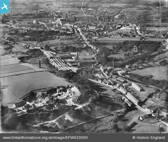
EPW019000 ENGLAND (1927). The Turn Lee Paper Mills and environs, Glossop, 1927
© Copyright OpenStreetMap contributors and licensed by the OpenStreetMap Foundation. 2026. Cartography is licensed as CC BY-SA.
Nearby Images (6)
EPW019000

EPW018997

EPW018999

EPW019002

EPW019003

EPW018998

Details
| Title | [EPW019000] The Turn Lee Paper Mills and environs, Glossop, 1927 |
| Reference | EPW019000 |
| Date | July-1927 |
| Link | |
| Place name | GLOSSOP |
| Parish | |
| District | |
| Country | ENGLAND |
| Easting / Northing | 403304, 393050 |
| Longitude / Latitude | -1.9502627847813, 53.433964496538 |
| National Grid Reference | SK033931 |
Pins
Be the first to add a comment to this image!