
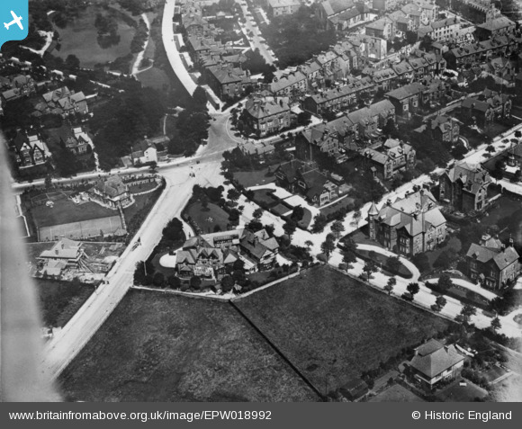
EPW018992 ENGLAND (1927). The junction of Temple Road and West Street, Buxton, 1927. This image has been produced from a copy-negative.
© Copyright OpenStreetMap contributors and licensed by the OpenStreetMap Foundation. 2026. Cartography is licensed as CC BY-SA.
Nearby Images (5)
EPW018992

EPW034104

EPW034112

EPW018986

EPW018987

Details
| Title | [EPW018992] The junction of Temple Road and West Street, Buxton, 1927. This image has been produced from a copy-negative. |
| Reference | EPW018992 |
| Date | 25-July-1927 |
| Link | |
| Place name | BUXTON |
| Parish | |
| District | |
| Country | ENGLAND |
| Easting / Northing | 405453, 372861 |
| Longitude / Latitude | -1.9182603753854, 53.252453814377 |
| National Grid Reference | SK055729 |
Pins
Be the first to add a comment to this image!