
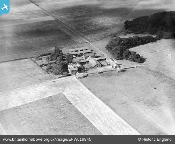
EPW018945 ENGLAND (1927). Haydock Park Farm, Haydock, 1927
© Copyright OpenStreetMap contributors and licensed by the OpenStreetMap Foundation. 2026. Cartography is licensed as CC BY-SA.
Nearby Images (4)
EPW018945

EPW018944

EPW018943

EPW018942

Details
| Title | [EPW018945] Haydock Park Farm, Haydock, 1927 |
| Reference | EPW018945 |
| Date | July-1927 |
| Link | |
| Place name | HAYDOCK |
| Parish | |
| District | |
| Country | ENGLAND |
| Easting / Northing | 358481, 397129 |
| Longitude / Latitude | -2.625530179242, 53.469006000106 |
| National Grid Reference | SJ585971 |
Pins
Be the first to add a comment to this image!