
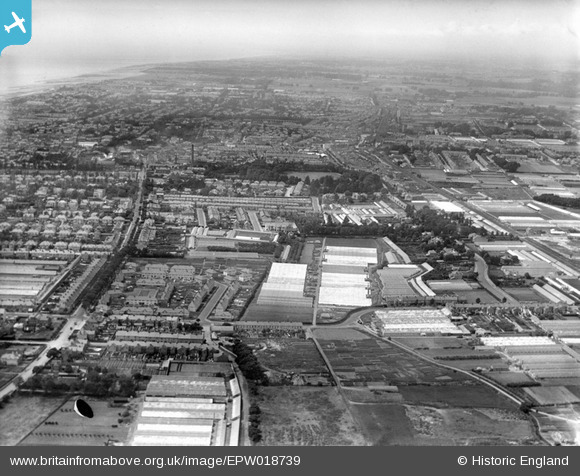
EPW018739 ENGLAND (1927). Homefield Park, Chesswood Road nurseries and environs, Worthing, from the east, 1927
© Copyright OpenStreetMap contributors and licensed by the OpenStreetMap Foundation. 2026. Cartography is licensed as CC BY-SA.
Nearby Images (2)
EPW018739

EPW018754

Details
| Title | [EPW018739] Homefield Park, Chesswood Road nurseries and environs, Worthing, from the east, 1927 |
| Reference | EPW018739 |
| Date | July-1927 |
| Link | |
| Place name | WORTHING |
| Parish | |
| District | |
| Country | ENGLAND |
| Easting / Northing | 515965, 103394 |
| Longitude / Latitude | -0.3535932102454, 50.817903990965 |
| National Grid Reference | TQ160034 |
Pins

SophieWattsit |
Sunday 19th of April 2026 09:35:45 PM | |
|
SophieWattsit |
Sunday 19th of April 2026 09:34:17 PM | |
|
SophieWattsit |
Sunday 19th of April 2026 09:33:04 PM | |
|
SophieWattsit |
Sunday 17th of September 2023 01:01:06 AM | |
|
SophieWattsit |
Tuesday 9th of February 2021 11:34:07 PM |