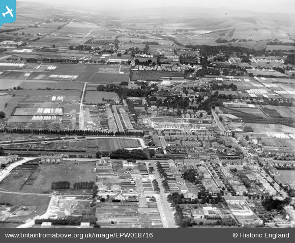
EPW018716 ENGLAND (1927). West Worthing and West Tarring, Worthing, from the south, 1927
© Copyright OpenStreetMap contributors and licensed by the OpenStreetMap Foundation. 2026. Cartography is licensed as CC BY-SA.
Details
| Title | [EPW018716] West Worthing and West Tarring, Worthing, from the south, 1927 |
| Reference | EPW018716 |
| Date | July-1927 |
| Link | |
| Place name | WORTHING |
| Parish | |
| District | |
| Country | ENGLAND |
| Easting / Northing | 513194, 103253 |
| Longitude / Latitude | -0.39296111985089, 50.817184788659 |
| National Grid Reference | TQ132033 |


![[EPW018716] West Worthing and West Tarring, Worthing, from the south, 1927](http://britainfromabove.org.uk/sites/all/libraries/aerofilms-images/public/100x100/EPW/018/EPW018716.jpg)
![[EPW018721] West Worthing and West Tarring, Worthing, from the south, 1927](http://britainfromabove.org.uk/sites/all/libraries/aerofilms-images/public/100x100/EPW/018/EPW018721.jpg)
![[EPW018719] West Worthing and West Tarring, Worthing, from the south-west, 1927](http://britainfromabove.org.uk/sites/all/libraries/aerofilms-images/public/100x100/EPW/018/EPW018719.jpg)
![[EPW018720] West Tarring, Worthing, from the south, 1927](http://britainfromabove.org.uk/sites/all/libraries/aerofilms-images/public/100x100/EPW/018/EPW018720.jpg)
