
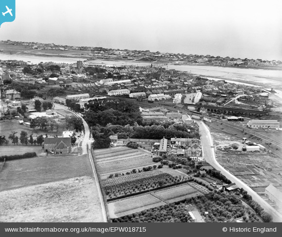
EPW018715 ENGLAND (1927). The town centre, Shoreham-by-Sea, from the north-west, 1927
© Copyright OpenStreetMap contributors and licensed by the OpenStreetMap Foundation. 2026. Cartography is licensed as CC BY-SA.
Nearby Images (2)
EPW018715

EPW054138

Details
| Title | [EPW018715] The town centre, Shoreham-by-Sea, from the north-west, 1927 |
| Reference | EPW018715 |
| Date | July-1927 |
| Link | |
| Place name | SHOREHAM-BY-SEA |
| Parish | |
| District | |
| Country | ENGLAND |
| Easting / Northing | 521190, 105471 |
| Longitude / Latitude | -0.27875989332811, 50.83550506348 |
| National Grid Reference | TQ212055 |
Pins

ALAN S |
Sunday 31st of January 2016 12:13:06 PM | |
In operation from 1861 to 1966. |
SAS |
Tuesday 29th of November 2016 11:17:59 PM |

Alan McFaden |
Monday 2nd of December 2013 08:55:31 PM | |
|
Alan McFaden |
Monday 2nd of December 2013 08:53:17 PM | |
Now demolished. Replacement footbridge opened in Autumn 2013 |
Biggles1951 |
Thursday 12th of December 2013 06:25:05 PM |
|
Alan McFaden |
Monday 2nd of December 2013 08:51:53 PM |


User Comment Contributions
The line going to the right is the Railway towards Worthing, and below it is the now derelict line towards Bramber and Steyning. This line is now a cycle path and the Steyning bypass! |
tomoliver |
Sunday 12th of August 2012 04:35:10 PM |

Shoreham town centre with the line going towards Worthing and below it is the now disused line to Beeding cement works, Bramber, Steyning. This line is now a cycle path and the Steyning bypass! |
tomoliver |
Sunday 12th of August 2012 04:33:35 PM |