
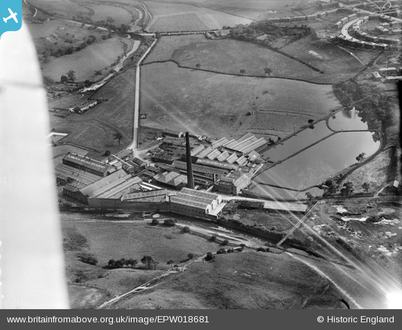
EPW018681 ENGLAND (1927). Firwood Bleach Works, Firwood Fold, 1927
© Copyright OpenStreetMap contributors and licensed by the OpenStreetMap Foundation. 2026. Cartography is licensed as CC BY-SA.
Nearby Images (13)
EPW018681

EPW018678

EPW017803

EPW017804

EPW018680

EPW018677

EPW018679

EPW018683

EPW017805

EPW018682

EPW017800

EPW017802

EPW017806

Details
| Title | [EPW018681] Firwood Bleach Works, Firwood Fold, 1927 |
| Reference | EPW018681 |
| Date | 2-July-1927 |
| Link | |
| Place name | FIRWOOD FOLD |
| Parish | |
| District | |
| Country | ENGLAND |
| Easting / Northing | 373429, 410972 |
| Longitude / Latitude | -2.4015049072984, 53.594410018862 |
| National Grid Reference | SD734110 |
Pins

WunaLoonaMoon |
Wednesday 20th of November 2019 01:45:10 AM | |

JMB |
Wednesday 18th of July 2012 07:52:38 PM |