
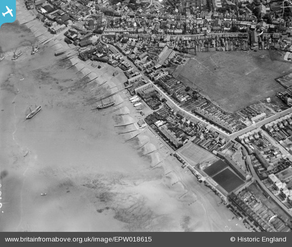
EPW018615 ENGLAND (1927). Island Wall and environs, Whitstable, 1927
© Copyright OpenStreetMap contributors and licensed by the OpenStreetMap Foundation. 2026. Cartography is licensed as CC BY-SA.
Nearby Images (5)
EPW018615

EPW054081

EPW054078

EPW000651

EPW018620

Details
| Title | [EPW018615] Island Wall and environs, Whitstable, 1927 |
| Reference | EPW018615 |
| Date | 22-June-1927 |
| Link | |
| Place name | WHITSTABLE |
| Parish | |
| District | |
| Country | ENGLAND |
| Easting / Northing | 610386, 166525 |
| Longitude / Latitude | 1.0221774174592, 51.358275122965 |
| National Grid Reference | TR104665 |
Pins

Kentishman |
Wednesday 9th of July 2014 12:11:03 AM | |
|
Kentishman |
Wednesday 9th of July 2014 12:09:59 AM |