
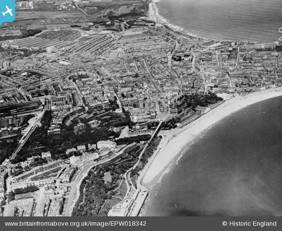
EPW018342 ENGLAND (1927). South Sands, St Nicholas Cliff and environs, Scarborough, 1927. This image has been produced from a copy-negative.
© Copyright OpenStreetMap contributors and licensed by the OpenStreetMap Foundation. 2026. Cartography is licensed as CC BY-SA.
Nearby Images (5)
EPW018342

EPW038932

EAW007953

EAW016693

EAW007954

Details
| Title | [EPW018342] South Sands, St Nicholas Cliff and environs, Scarborough, 1927. This image has been produced from a copy-negative. |
| Reference | EPW018342 |
| Date | 10-June-1927 |
| Link | |
| Place name | SCARBOROUGH |
| Parish | |
| District | |
| Country | ENGLAND |
| Easting / Northing | 504286, 488377 |
| Longitude / Latitude | -0.39805330921531, 54.280221387643 |
| National Grid Reference | TA043884 |
Pins

Mullenaround |
Friday 31st of January 2025 01:10:08 PM |