
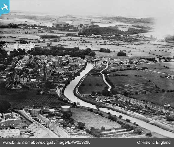
EPW018260 ENGLAND (1927). The River Arun and the town, Arundel, from the west, 1927. This image has been produced from a copy-negative.
© Copyright OpenStreetMap contributors and licensed by the OpenStreetMap Foundation. 2025. Cartography is licensed as CC BY-SA.
Nearby Images (3)
EPW018260

EPW017745

EPW000727

Details
| Title | [EPW018260] The River Arun and the town, Arundel, from the west, 1927. This image has been produced from a copy-negative. |
| Reference | EPW018260 |
| Date | 10-June-1927 |
| Link | |
| Place name | ARUNDEL |
| Parish | ARUNDEL |
| District | |
| Country | ENGLAND |
| Easting / Northing | 501410, 106742 |
| Longitude / Latitude | -0.55923568421039, 50.850737301297 |
| National Grid Reference | TQ014067 |
Pins
Be the first to add a comment to this image!