
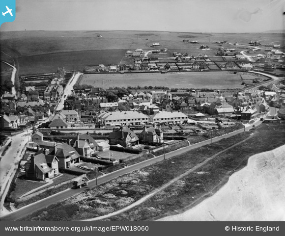
EPW018060 ENGLAND (1927). Marine Drive and St Aubyns School playing field, Rottingdean, from the south-west, 1927
© Copyright OpenStreetMap contributors and licensed by the OpenStreetMap Foundation. 2026. Cartography is licensed as CC BY-SA.
Nearby Images (11)
EPW018060

EPW018064

EPW035299

EPW035300

EPW018056

EPW018058

EPW018055

EPW018057

EAW024794

EPW018061

EPW041382

Details
| Title | [EPW018060] Marine Drive and St Aubyns School playing field, Rottingdean, from the south-west, 1927 |
| Reference | EPW018060 |
| Date | May-1927 |
| Link | |
| Place name | ROTTINGDEAN |
| Parish | ROTTINGDEAN |
| District | |
| Country | ENGLAND |
| Easting / Northing | 536716, 102285 |
| Longitude / Latitude | -0.0595619680648, 50.803408138702 |
| National Grid Reference | TQ367023 |
Pins
Be the first to add a comment to this image!