
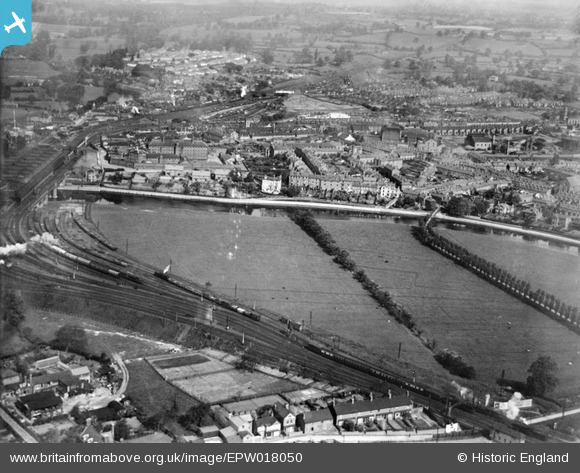
EPW018050 ENGLAND (1927). Castle Fields, Shrewsbury, from the south-east, 1927
© Copyright OpenStreetMap contributors and licensed by the OpenStreetMap Foundation. 2026. Cartography is licensed as CC BY-SA.
Nearby Images (3)
EPW018050

EPW018046

EAW012519

Details
| Title | [EPW018050] Castle Fields, Shrewsbury, from the south-east, 1927 |
| Reference | EPW018050 |
| Date | May-1927 |
| Link | |
| Place name | SHREWSBURY |
| Parish | SHREWSBURY |
| District | |
| Country | ENGLAND |
| Easting / Northing | 349797, 312861 |
| Longitude / Latitude | -2.7431863529207, 52.710738233519 |
| National Grid Reference | SJ498129 |
Pins

Penny Ward |
Friday 4th of March 2022 05:45:28 PM | |
|
Redford-Jones |
Sunday 29th of March 2020 07:20:39 PM | |
|
kw66 |
Wednesday 8th of January 2020 11:27:55 PM | |
|
kw66 |
Wednesday 8th of January 2020 11:22:54 PM | |
|
kw66 |
Wednesday 8th of January 2020 11:21:19 PM | |
|
MB |
Tuesday 11th of December 2012 10:35:15 AM | |
|
MB |
Tuesday 11th of December 2012 10:34:52 AM | |
|
MB |
Tuesday 11th of December 2012 10:33:04 AM | |
|
MB |
Tuesday 11th of December 2012 10:32:16 AM | |
|
MB |
Tuesday 11th of December 2012 10:31:33 AM | |
|
MB |
Tuesday 11th of December 2012 10:30:03 AM | |
|
MB |
Tuesday 11th of December 2012 10:28:22 AM | |
|
MB |
Tuesday 11th of December 2012 10:27:39 AM |