
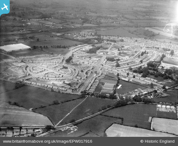
EPW017916 ENGLAND (1927). Housing Estate under construction, Low Hill, 1927
© Copyright OpenStreetMap contributors and licensed by the OpenStreetMap Foundation. 2026. Cartography is licensed as CC BY-SA.
Nearby Images (6)
EPW017916

EPW015220

EPW061264

EPW017912

EPW017918

EPW017919

Details
| Title | [EPW017916] Housing Estate under construction, Low Hill, 1927 |
| Reference | EPW017916 |
| Date | 11-May-1927 |
| Link | |
| Place name | LOW HILL |
| Parish | |
| District | |
| Country | ENGLAND |
| Easting / Northing | 392584, 301143 |
| Longitude / Latitude | -2.1095249486752, 52.607663164245 |
| National Grid Reference | SJ926011 |
Pins
Be the first to add a comment to this image!