
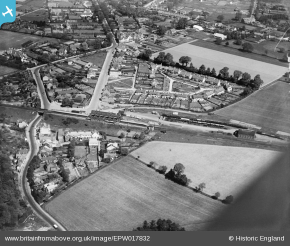
EPW017832 ENGLAND (1927). Amersham Station and Elm Close, Amersham, 1927
© Copyright OpenStreetMap contributors and licensed by the OpenStreetMap Foundation. 2026. Cartography is licensed as CC BY-SA.
Nearby Images (4)
EPW017832

EAW026491

EAW026492

EAW026490

Details
| Title | [EPW017832] Amersham Station and Elm Close, Amersham, 1927 |
| Reference | EPW017832 |
| Date | April-1927 |
| Link | |
| Place name | AMERSHAM |
| Parish | AMERSHAM |
| District | |
| Country | ENGLAND |
| Easting / Northing | 496449, 198193 |
| Longitude / Latitude | -0.60502411744392, 51.673753518934 |
| National Grid Reference | SU964982 |
Pins

mike |
Monday 22nd of November 2021 03:02:52 PM | |
|
bondi |
Saturday 20th of December 2014 12:06:49 AM | |
|
Waddy |
Wednesday 12th of November 2014 12:04:50 PM | |
|
Tom |
Thursday 20th of September 2012 12:58:52 PM | |
|
Tom |
Thursday 20th of September 2012 12:58:28 PM | |
|
Tom |
Thursday 20th of September 2012 12:58:06 PM | |
|
Tom |
Thursday 20th of September 2012 12:54:48 PM | |
|
Tom |
Thursday 20th of September 2012 12:52:06 PM |
User Comment Contributions

Amersham Station (Buckinghamshire) Note the vast number of goods wagons visible. |
Puffpuffbuff |
Tuesday 26th of June 2012 07:58:01 AM |