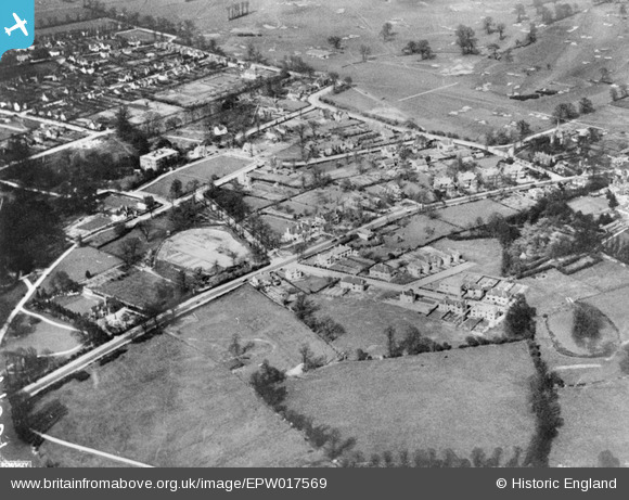
EPW017569 ENGLAND (1927). The Gidea Park Estate, Gidea Park, 1927
© Copyright OpenStreetMap contributors and licensed by the OpenStreetMap Foundation. 2025. Cartography is licensed as CC BY-SA.
Nearby Images (5)
Details
| Title | [EPW017569] The Gidea Park Estate, Gidea Park, 1927 |
| Reference | EPW017569 |
| Date | 12-April-1927 |
| Link | |
| Place name | GIDEA PARK |
| Parish | |
| District | |
| Country | ENGLAND |
| Easting / Northing | 552210, 189733 |
| Longitude / Latitude | 0.19726647217728, 51.585393751811 |
| National Grid Reference | TQ522897 |


![[EPW017569] The Gidea Park Estate, Gidea Park, 1927](http://britainfromabove.org.uk/sites/all/libraries/aerofilms-images/public/100x100/EPW/017/EPW017569.jpg)
![[EPW017567] The Gidea Park Estate and Romford Golf Course, Gidea Park, from the south-west, 1927](http://britainfromabove.org.uk/sites/all/libraries/aerofilms-images/public/100x100/EPW/017/EPW017567.jpg)
![[EPW017570] The Gidea Park Estate and Romford Golf Course, Gidea Park, from the south-east, 1927](http://britainfromabove.org.uk/sites/all/libraries/aerofilms-images/public/100x100/EPW/017/EPW017570.jpg)
![[EPW017568] Gidea Hall, Gidea Park, 1927](http://britainfromabove.org.uk/sites/all/libraries/aerofilms-images/public/100x100/EPW/017/EPW017568.jpg)
![[EPW017562] The Gidea Park Estate, Gidea Park, from the south-east, 1927](http://britainfromabove.org.uk/sites/all/libraries/aerofilms-images/public/100x100/EPW/017/EPW017562.jpg)
