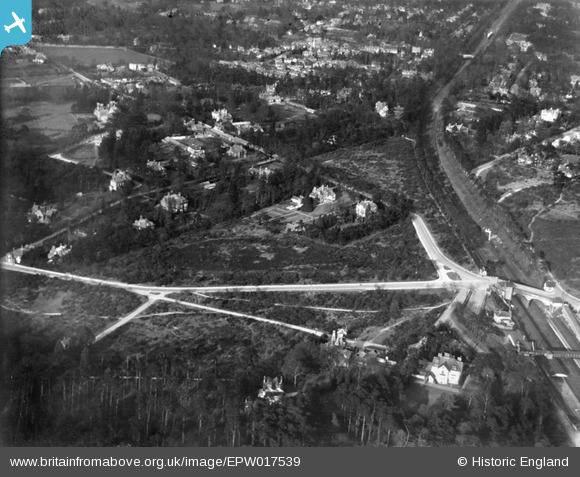
EPW017539 ENGLAND (1927). Weybridge Station and The Heath, Weybridge, 1927
© Copyright OpenStreetMap contributors and licensed by the OpenStreetMap Foundation. 2026. Cartography is licensed as CC BY-SA.
Details
| Title | [EPW017539] Weybridge Station and The Heath, Weybridge, 1927 |
| Reference | EPW017539 |
| Date | 8-April-1927 |
| Link | |
| Place name | WEYBRIDGE |
| Parish | |
| District | |
| Country | ENGLAND |
| Easting / Northing | 507532, 163887 |
| Longitude / Latitude | -0.45525699177519, 51.363357881087 |
| National Grid Reference | TQ075639 |
Pins

richardj |
Wednesday 8th of March 2017 02:35:36 PM | |

richardj |
Wednesday 8th of March 2017 02:31:12 PM | |

richardj |
Friday 3rd of March 2017 06:02:47 PM | |

richardj |
Friday 3rd of March 2017 06:00:40 PM | |

richardj |
Friday 3rd of March 2017 05:59:23 PM | |

richardj |
Friday 3rd of March 2017 05:58:49 PM | |

Class31 |
Friday 7th of September 2012 08:57:04 PM |


![[EPW017539] Weybridge Station and The Heath, Weybridge, 1927](http://britainfromabove.org.uk/sites/all/libraries/aerofilms-images/public/100x100/EPW/017/EPW017539.jpg)
![[EPW017544] Weybridge Station and The Heath looking towards the River Thames, Weybridge, from the south-west, 1927](http://britainfromabove.org.uk/sites/all/libraries/aerofilms-images/public/100x100/EPW/017/EPW017544.jpg)
![[EPW017546] Mansfield Close and environs, Weybridge, 1927](http://britainfromabove.org.uk/sites/all/libraries/aerofilms-images/public/100x100/EPW/017/EPW017546.jpg)
![[EPW023389] Weybridge Railway Station, Weybridge, 1928](http://britainfromabove.org.uk/sites/all/libraries/aerofilms-images/public/100x100/EPW/023/EPW023389.jpg)