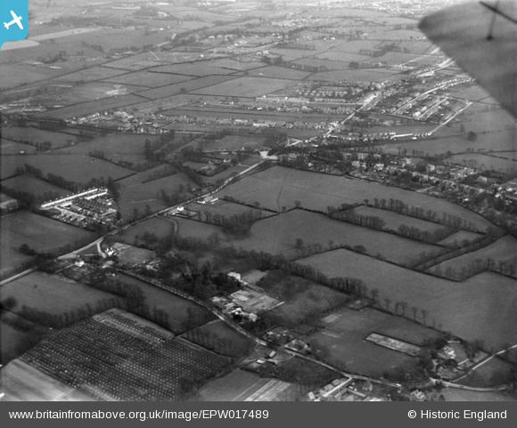
EPW017489 ENGLAND (1927). Fields between Malden and Worcester Park, Old Malden, from the north-west, 1927
    © Copyright OpenStreetMap contributors and licensed by the OpenStreetMap Foundation. 2025. Cartography is licensed as CC BY-SA.
  
Details
| Title | [EPW017489] Fields between Malden and Worcester Park, Old Malden, from the north-west, 1927 | 
| Reference | EPW017489 | 
| Date | 23-March-1927 | 
| Link | |
| Place name | OLD MALDEN | 
| Parish | |
| District | |
| Country | ENGLAND | 
| Easting / Northing | 521572, 166263 | 
| Longitude / Latitude | -0.25284832833538, 51.381882597629 | 
| National Grid Reference | TQ216663 | 
 
             
  ![[EPW017489] Fields between Malden and Worcester Park, Old Malden, from the north-west, 1927](http://britainfromabove.org.uk/sites/all/libraries/aerofilms-images/public/100x100/EPW/017/EPW017489.jpg) 
  
                                          ![[EPW017486] Fields between Malden and Worcester Park, Old Malden, from the west, 1927](http://britainfromabove.org.uk/sites/all/libraries/aerofilms-images/public/100x100/EPW/017/EPW017486.jpg) 
 ![[EPW017488] Malden village, Old Malden, 1927](http://britainfromabove.org.uk/sites/all/libraries/aerofilms-images/public/100x100/EPW/017/EPW017488.jpg) 
 ![[EPW017480] Fields between Malden and Worcester Park, Old Malden, 1927](http://britainfromabove.org.uk/sites/all/libraries/aerofilms-images/public/100x100/EPW/017/EPW017480.jpg) 
  Church Road
 Church Road